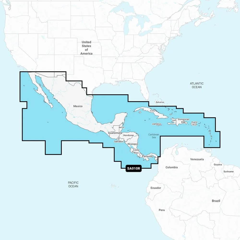
NASA010R - Central America & Caribbean - Navionics+ Get the world’s No. 1 choice in marine mapping with the best, most up-to-date Navionics+ cartography on a compatible chartplotter. For offshore or inland waters, this all-in-one solution offers detail-rich integrated mapping of coastal waters, lakes and rivers, plus SonarChart 1' (0.5 m) HD bathymetry maps and advanced features such as dock-to-dock route guidance, live mapping and Plotter Sync for wireless access to daily updates. Coverage includes detailed west coast of Mexico from Tijuana to Panama (including the Panama Canal), east coast coverage from Panama to Brownsville, TX, and Caribbean coverage including the Bahamas, Turks & Caicos, Cuba, Jamaica, the Caymans, Haiti, Dominican Republic, Puerto Rico and the Lesser Antilles to Grenada. Features include Coastal Content, 44,000+ lakes inland content, SonarChart HD bathymetry, up to 5,000 daily updates, community edits via Navionics Boating app, advanced map options and SonarChart Live mapping. Format: SD/MSD Card. In the box: SD/MSD Card.
Specifications:
| Materials & Construction |
| Color | Black |
| Material | Plastic |
| Product Details |
| Included Components | Great Product |
| Map scale | 1:50,000 or smaller |
| Model Name | 010-C1459-30 |
| Mounting Type | Base Mount |
| Special Feature | Waterproof, Portable |
| Style | Modern |
| Sizing & Dimensions |
| Height | 1 inches |
| Length | 6 inches |
| Package Dimensions | 5.9 x 4.11 x 1 inches |
| Product Dimensions | 6 x 4 x 1 inches |
| Weight | 3.17 ounces |
| Width | 4 inches |
| Technical Specifications |
| Item Dimensions Lx Wx H | 6 x 4 x 1 inches |
| Item Package Dimensions L x W x H | 5.9 x 4.11 x 1 inches |
| Mounting Type | Base Mount |
| Warranty Description | Warranty |